
An official website of the United States government
An official website of the United States government
The .gov means it's official.
Federal government websites often end in .gov or .mil. Before sharing sensitive information,
make sure you're on a federal government site.
The site is secure.
The
https:// ensures that you are connecting to the official website and that any
information you provide is encrypted and transmitted securely.
The National Hurricane Center has announced that Hurricane Arthur is expected to affect North Carolina. 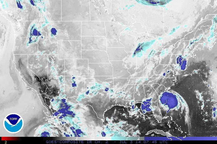 BLS maps and tables are available for areas in North Carolina that may be affected by this event. For more information on hurricanes, see the National Hurricane Center website, www.nhc.noaa.gov.
The Quarterly Census of Employment and Wages (QCEW) program has created a set of maps and data for hurricane flood zones on the Gulf and Atlantic Coasts. Where permitted by State regulations, maps include dots indicating the location of business and government establishments. This product is the combination of geocoded BLS establishment data and flood zones created by the U. S. Corps of Engineers and State emergency management authorities. For more information, see the flood zone Questions and Answers page.
The summarized data are presented for each zone. If a Category I storm is experienced, the subject establishments are represented by the Category I sums. The Category II sums represent the establishments which are not in zone I but are in zone II. To get a total for establishments subject to a Category II storm, users should add the Category I and II values.
Last Modified Date: July 3, 2014